
基本信息
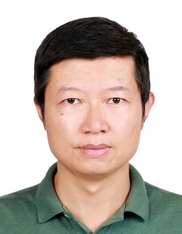
历华 中国科学院空天信息创新研究院
电子邮件: lihua@radi.ac.cn
通信地址: 北京市朝阳区大屯路20号北
邮政编码: 100101
电子邮件: lihua@radi.ac.cn
通信地址: 北京市朝阳区大屯路20号北
邮政编码: 100101
研究领域
研究领域:热红外定量遥感
主要研究方向:红外地表参数智能反演、遥感产品业务化生产及真实性检验、城市热环境等应用
招生信息
欢迎有遥感、地理、地信、测绘、水文气象、环境、计算机等专业背景,热爱科研、积极乐观、对定量遥感相关方向感兴趣的学生报考。
招生专业:遥感科学与技术,测绘工程
招生方向
热红外遥感,定量遥感
教育背景
2007-09--2010-06 中国科学院遥感应用研究所 博士2004-09--2007-06 中南大学 硕士2000-09--2004-06 西安科技大学 本科
工作经历
工作简历
2020-03~现在, 中国科学院空天信息创新研究院, 副研究员2014-02~2020-02,中国科学院遥感与数字地球研究所, 副研究员2012-11~2013-09,美国乔治梅森大学, 访问学者2010-07~2012-10,中国科学院遥感应用研究所, 助理研究员
社会兼职
2022-04-01-今,中国遥感应用协会热红外遥感专业委员会, 委员
2021-12-31-2025-08-30,中国遥感应用协会黄土高原遥感分会, 委员
2021-08-01-2026-08-31,中国遥感应用协会定量遥感专业委员会, 青年委员
2021-04-01-今,中国气象服务协会人工智能技术委员会, 委员
2020-11-30-2024-12-30,遥感学报, 青年编委
2021-12-31-2025-08-30,中国遥感应用协会黄土高原遥感分会, 委员
2021-08-01-2026-08-31,中国遥感应用协会定量遥感专业委员会, 青年委员
2021-04-01-今,中国气象服务协会人工智能技术委员会, 委员
2020-11-30-2024-12-30,遥感学报, 青年编委
出版信息
发表论文
(1) Angular normalization of GOES-16 and GOES-17 land surface temperature over overlapping region using an extended time-evolving kernel-driven model, REMOTE SENSING OF ENVIRONMENT, 2025, 第 13 作者(2) Evaluation of Three Modeling Frameworks of Thermal Infrared Radiative Transfer for Directional Anisotropies of Temperatures, IEEE TRANSACTIONS ON GEOSCIENCE AND REMOTE SENSING, 2025, 第 4 作者 通讯作者(3) Stripe Noise Elimination with a Novel Trend Repair Method for Push-Broom Thermal Images, REMOTE SENSING, 2024, 第 2 作者 通讯作者(4) An integrated method for angular and temporal reconstruction of land surface temperatures, Remote Sensing of Environment,313, 114357, 2024, 第 6 作者 通讯作者(5) Comprehensive Analysis of Current 1-km Land Surface Temperature Products in Sparsely Vegetated Area: T-Based Evaluation, Thermal Anisotropy, and Joint Application, IEEE Transactions on Geoscience and Remote Sensing, 62., 2024, 第 2 作者(6) Correcting an Off-Nadir to a Nadir Land Surface Temperature Using a Multitemporal Thermal Infrared Kernel-Driven Model during Daytime, REMOTE SENSING, 2024, 第 7 作者(7) Modeling the Topographic Effect on Directional Anisotropies of Land Surface Temperature from Thermal Remote Sensing, Journal of Remote Sensing, 4, 0226, 2024, (8) Investigating Land Cover Changes and Their Impact on Land Surface Temperature in Khyber Pakhtunkhwa, Pakistan, SUSTAINABILITY, 2024, 第 2 作者 通讯作者(9) A Consistency Analysis of Land Surface Temperatures Retrieved From Several Polar-Orbiting Satellite Observations, IEEE TRANSACTIONS ON GEOSCIENCE AND REMOTE SENSING, 2024, 第 2 作者(10) Estimation and Evaluation of 15 Minute, 40 Meter Surface Upward Longwave Radiation Downscaled from the Geostationary FY-4B AGRI, REMOTE SENSING, 2024, 第 7 作者(11) An analytical urban temperature model with building heterogeneity using geometric optical theory, REMOTE SENSING OF ENVIRONMENT, 2024, 第 8 作者 通讯作者(12) Innovative hybrid algorithm for simultaneous land surface temperature and emissivity retrieval: Case study with SDGSAT-1 data, REMOTE SENSING OF ENVIRONMENT, 2024, 第 8 作者(13) An Operational Split-Window Algorithm for Generating Long-Term Land Surface Temperature Products From Chinese Fengyun-3 Series Satellite Data, IEEE TRANSACTIONS ON GEOSCIENCE AND REMOTE SENSING, 2023, 第 1 作者(14) A thermal radiation directionality correction method for the surface upward longwave radiation of geostationary satellite based on a time-evolving kernel-driven model, REMOTE SENSING OF ENVIRONMENT, 2023, 第 9 作者(15) Land Surface Temperature Retrieval From Sentinel-3A SLSTR Data: Comparison Among Split-Window, Dual-Window, Three-Channel, and Dual-Angle Algorithms, IEEE TRANSACTIONS ON GEOSCIENCE AND REMOTE SENSING, 2023, 第 2 作者 通讯作者(16) Land Surface Temperature Retrieval From Landsat 9 TIRS-2 Data Using Radiance-Based Split-Window Algorithm, IEEE JOURNAL OF SELECTED TOPICS IN APPLIED EARTH OBSERVATIONS AND REMOTE SENSING, 2023, 第 8 作者(17) Optimizing the Protocol of Near-Surface Remote Sensing Experiments Over Heterogeneous Canopy Using DART Simulated Images, IEEE Transactions on Geoscience and Remote Sensing, 2023, 第 9 作者(18) Correction for LST directionality impact on the estimation of surface upwelling longwave radiation over vegetated surfaces at the satellite scale, REMOTE SENSING OF ENVIRONMENT, 2023, 第 6 作者(19) Evaluation of Three Land Surface Temperature Products From Landsat Series Using in Situ Measurements, IEEE TRANSACTIONS ON GEOSCIENCE AND REMOTE SENSING, 2023, 第 7 作者(20) Assessment of Five Thermal Infrared Kernel-Driven Models Using Limited Multiangle Observations, IEEEGEOSCIENCEANDREMOTESENSINGLETTERS, 2022, 第 6 作者(21) Comparison between Physical and Empirical Methods for Simulating Surface Brightness Temperature Time Series, REMOTE SENSING, 2022, 第 8 作者 通讯作者(22) A TIR forest reflectance and transmittance (FRT) model for directional temperatures with structural and thermal stratification, REMOTE SENSING OF ENVIRONMENT, 2022, 第 5 作者(23) A GPU-Based Solution for Ray Tracing 3-D Radiative Transfer Model for Optical and Thermal Images, IEEE GEOSCIENCE AND REMOTE SENSING LETTERS, 2022, 第 6 作者(24) Temperature-Based and Radiance-Based Validation of the Collection 6 MYD11 and MYD21 Land Surface Temperature Products Over Barren Surfaces in Northwestern China, IEEE TRANSACTIONS ON GEOSCIENCE AND REMOTE SENSING, 2021, 第 1 作者(25) The Effects of Tree Trunks on the Directional Emissivity and Brightness Temperatures of a Leaf-Off Forest Using a Geometric Optical Model, IEEE TRANSACTIONS ON GEOSCIENCE AND REMOTE SENSING, 2021, 第 3 作者(26) A general framework of kernel-driven modeling in the thermal infrared domain, REMOTE SENSING OF ENVIRONMENT, 2021, 第 8 作者(27) Spatial Downscaling of MODIS Land Surface Temperature Based on a Geographically and Temporally Weighted Autoregressive Model, IEEE JOURNAL OF SELECTED TOPICS IN APPLIED EARTH OBSERVATIONS AND REMOTE SENSING, 2021, 第 4 作者(28) Modeling the directional anisotropy of fine-scale TIR emissions over tree and crop canopies based on UAV measurements, REMOTE SENSING OF ENVIRONMENT, 2021, 第 5 作者(29) A simple yet robust framework to estimate accurate daily mean land surface temperature from thermal observations of tandem polar orbiters, REMOTE SENSING OF ENVIRONMENT, 2021, 第 10 作者(30) Evaluation of Six High-Spatial Resolution Clear-Sky Surface Upward Longwave Radiation Estimation Methods with MODIS, REMOTE SENSING, 2020, 第 3 作者(31) An Efficient Framework for Producing Landsat-Based Land Surface Temperature Data Using Google Earth Engine, IEEE JOURNAL OF SELECTED TOPICS IN APPLIED EARTH OBSERVATIONS AND REMOTE SENSING, 2020, 第 7 作者(32) On agricultural drought monitoring in Australia using Himawari-8 geostationary thermal infrared observations, INTERNATIONAL JOURNAL OF APPLIED EARTH OBSERVATION AND GEOINFORMATION, 2020, 第 8 作者(33) Global comparison of diverse scaling factors and regression models for downscaling Landsat-8 thermal data, ISPRS JOURNAL OF PHOTOGRAMMETRY AND REMOTE SENSING, 2020, 第 7 作者(34) A Modified Interactive Spectral Smooth Temperature Emissivity Separation Algorithm for Low-Temperature Surface, IEEE TRANSACTIONS ON GEOSCIENCE AND REMOTE SENSING, 2020, 第 2 作者 通讯作者(35) Retrieving Soil and Vegetation Temperatures From Dual-Angle and Multipixel Satellite Observations, IEEE JOURNAL OF SELECTED TOPICS IN APPLIED EARTH OBSERVATIONS AND REMOTE SENSING, 2020, 第 2 作者 通讯作者(36) A semi-empirical approach for modeling the vegetation thermal infrared directional anisotropy of canopies based on using vegetation indices, ISPRS JOURNAL OF PHOTOGRAMMETRY AND REMOTE SENSING, 2020, 第 5 作者(37) Modeling Directional Brightness Temperature (DBT) over Crop Canopy with Effects of Intra-Row Heterogeneity, REMOTE SENSING, 2020, 第 3 作者(38) An Operational Split-Window Algorithm for Retrieving Land Surface Temperature from Geostationary Satellite Data: A Case Study on Himawari-8 AHI Data, REMOTE SENSING, 2020, 第 2 作者 通讯作者(39) On agricultural drought monitoring in Australia using Himawari-8 geostationary thermal infrared observations, INTERNATIONAL JOURNAL OF APPLIED EARTH OBSERVATIONS AND GEOINFORMATION, 2020, 第 8 作者
科研活动
科研项目
( 1 ) 基于多源热红外数据时空谱角信息的组分温度优化反演方法研究, 负责人, 国家任务, 2025-01--2028-12( 2 ) 星上处理分系统地表温度反演软件开发, 负责人, 境内委托项目, 2024-12--2026-11( 3 ) 热红外成像光谱观测平台, 负责人, 中国科学院计划, 2024-01--2025-12( 4 ) 陆表关键辐射参量像元尺度真值获取技术, 负责人, 国家任务, 2023-12--2026-11( 5 ) 基于多源遥感数据的地表温度角度归一化方法研究, 负责人, 国家任务, 2021-01--2024-12( 6 ) 高分共性产品真实性检验平台与产品定型分系统, 参与, 国家任务, 2019-06--2025-06
指导学生
现指导学生
张航宇 硕士研究生 085704-测绘工程